Auckland Council adopts NorthWest Spatial Strategy
By Iain McManus
Auckland Council has updated and adopted the NorthWest Spatial Land Use Strategy following public feedback over the Christmas period.
The strategy has been prepared to inform the future transport network planning being undertaken by Waka Kotahi, Auckland Transport and Auckland Council.
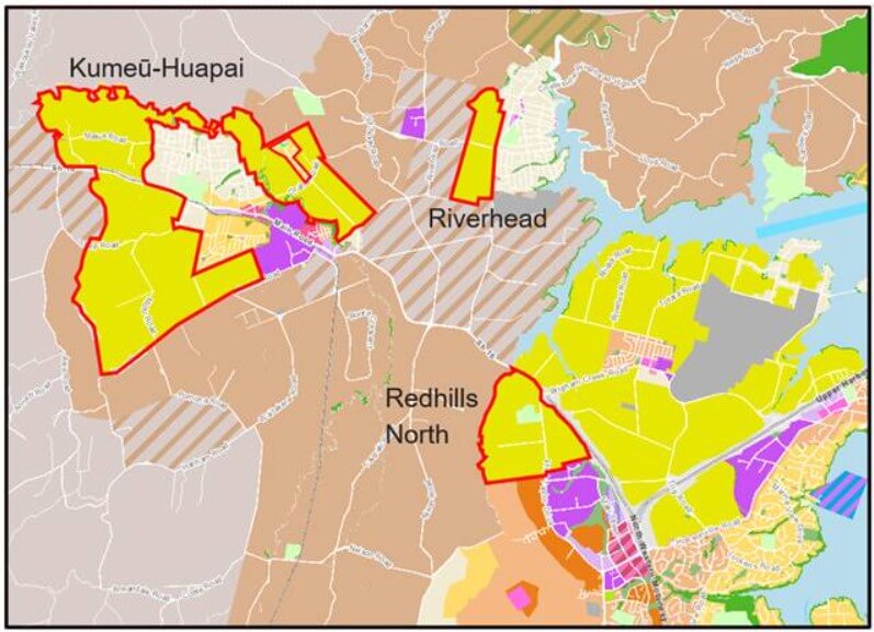
It provides a high-level overview of likely future land uses in the Future Urban zones around Kumeu-Huapai, Riverhead and Redhills North (areas shown in Figure 1 below).
Figure 1 – Study Areas
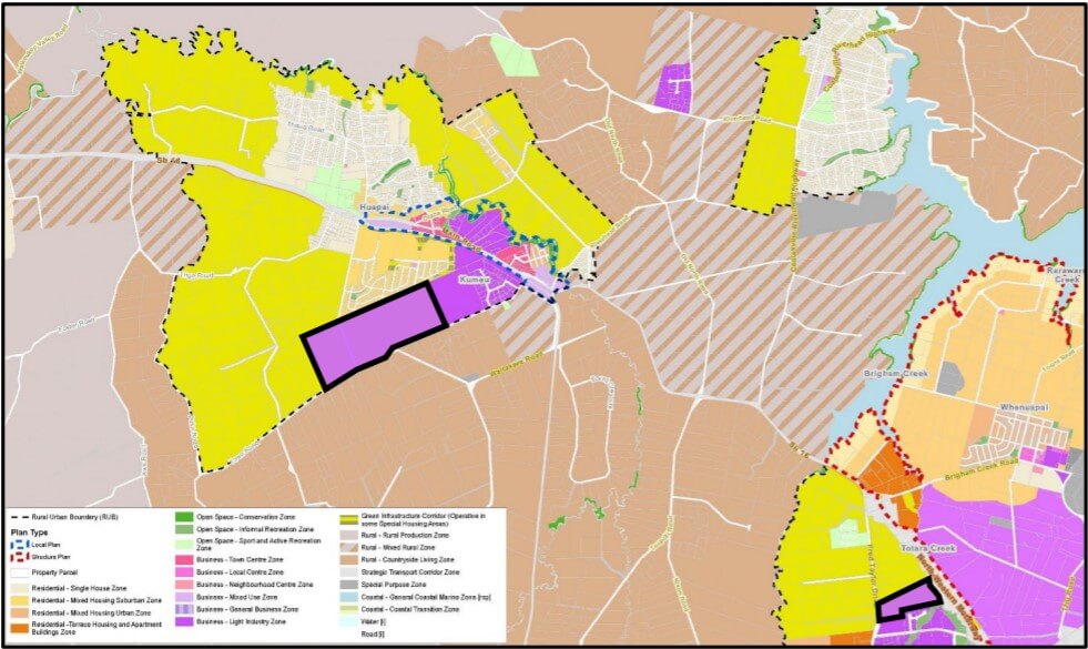
The strategy proposes approximately 70 hectares of new business / industrial zoned land in Kumeu and 10 hectares of new business / industrial zoned land in Redhills North, in the locations shown in Figure 2 below.
Figure 2 – Future Business Zones (purple areas outlined in black)
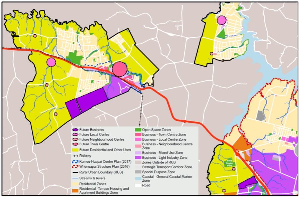
In addition, the strategy proposes:
- An expansion of the existing Town Centre in Kumeū-Huapai and the existing Local Centre in Riverhead.
- A new Local Centre west of Kumeū-Huapai along SH16 and smaller Neighbourhood Centres west of Kumeū-Huapai, south of Riverhead, and in Redhills North.
The approximate locations of these centre-expansion areas and new centres can be seen in Figure 3 below.
Figure 3 – New and Expanded Centres (circles of various sizes)
The strategy does not identify how the balance of the Future Urban land might be split between the various residential zones, open space zones or special purpose zones under the Unitary Plan. This more detailed work will need to be undertaken in a future structure plan for each area.
The Council has indicated that it will commence preparation of structure plans for the three areas around 2025 and that all three areas will be development-ready (i.e. zoned for urban development and provided with adequate infrastructure) between 2028 and 2032.
The strategy does not propose to shift the Rural Urban Boundary or identify any additional rural land for urbanisation, however, it does hint at where that urbanisation might occur in the future, as shown in Figure 4 below.
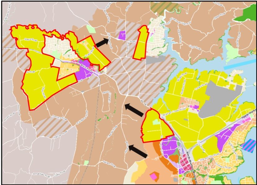 Figure 4 - Likely Future Urban Expansion (black arrows)
The strategy will now be used to identify and route-protect by purchase and/or designation the future transport network to and through these
areas.
Feel free to contact us if you'd like to find out more.